shorelines
Being from Hong Kong, where the coast has been dramatically reshaped over time and where the place I used to live sits on reclaimed land, I've always been fascinated by Boston's changing shoreline. With a 1630 map of Boston's shoreline in hand, I walked to the ends of the old streams in Fenway and Roxbury, areas that maps about landfilling tend to overlook, looking for traces of where water used to be and what has taken its place.
Recorded in January 2026, as part of Jacek Smolicki's J-term course - City by Sound: Practices, Poetics & Politics of Listening to Built & Natural Environments.


1. Forsyth Park
2. Peterborough St
3. Cabot St
4. Shawmut Ave
5. Bessie Barnes Park
6. Northeastern University Hurtig Hall
7. Northeastern University North Lot
8. Public Alley 818 - 21 Symphony Rd
9. Public Alley 818 - 70 Westland Ave
10. World War II Memorial
11. Boylston St - Fenway Health
12. Boylston St - Chase Bank
13. Van Ness St
14. Tetlow St
Before you explore, here is a composition of mixed field recordings from filled land in Boston (including some of the recordings below) and Hong Kong.
Boston / Kowloon


Forsyth Park
ice

Cabot Street
why are there so many beer bottle caps?


Shawmut Ave
jugs/cans/bottles, lottery tickets, birds


water as vibration / destabilizing our reality / reminding us reality is not fixed
Northeastern University Hurtig Hall
fire


Northeastern North Lot
jersey barriers


turns out the red one was a fake! it was filled with gravel instead of water

the white ones are real!

The jersey barrier is to water what Northeastern is to movement. The barrier denies water of its fluidity, movement, and tendency to overflow. It tries to control, to say here and no further.
Public Alley 818 - 21 Symphony Road & 70 Westland Ave

21 Symphony Road:
steam, water dripping on cardboard next to trash,
a mouse trap, a tiny dead mouse.


(with the dripping you can't see)
70 Westland Ave:


Huntington Tower - a mixed-use building under construction targeted to complete in summer 2026.
water as waste, as byproduct
Word War II Memorial
world war II memorial
vietnam memorial
korean memorial


(mostly geese eating)


Back Bay Fens


water as theater and battlefield, as enabler/platform for destruction
Boylston St - by Fenway Health
traffic flow

traffic
traffic light


traffic like water; water as opportunistic, flexible, adaptable
Boylston St - Chase Bank
many drains
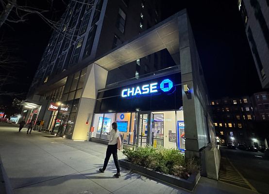


The constant creaking of the door and chatting come from the entrance of The Bon, a building where studio rents start at $3,200 and whose London-based developer has recently filed for bankruptcy amid a lawsuit over blocked refinancing.
money down the drain
Van Ness St - by Fenway Park
loading dock


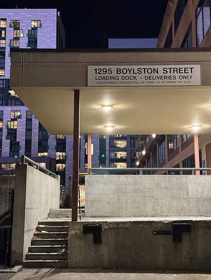
The way the parking lot slopes down and the loading dock next to it has so many cigarette butts, made it the easiest spot for me to visualize where a water body used to be.
Tetlow St
backflow preventer


I ran my microphone along the pipes from left to right. The center of the ring (in the zoomed in photo) sounded the loudest.

that is unable to prevent the backflow of floodwater, water that's returning to where it came from. This location (red X) will be 1.5–2 feet underwater in the 2070 Massachusetts Coastal Flood Risk Model. And most of what's filled land is going to return to water again.